
How Google Street View Routes Can Boost Footfall & Visibility
Insights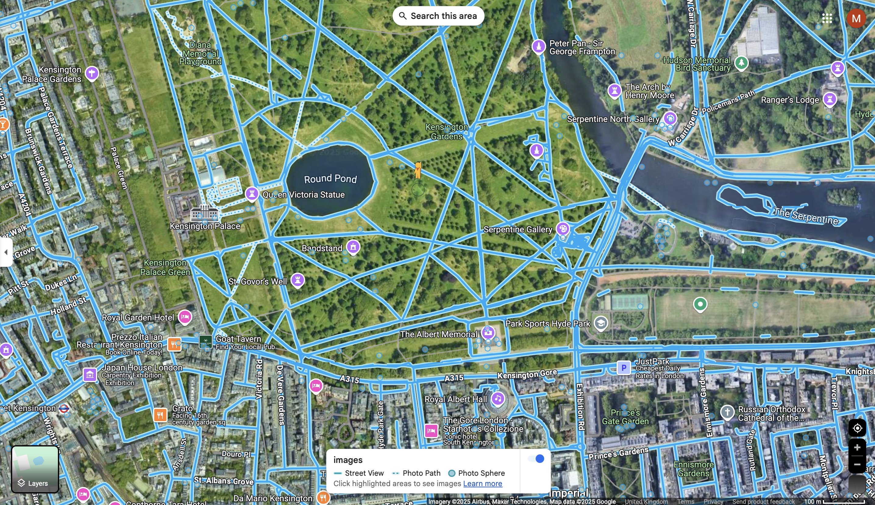
The Power of the Blue Line: How Google Street View Routes Can Boost Footfall and Visibility
When you think of Google Street View, you probably picture the familiar roadside imagery captured by Google’s iconic cars. But did you know that businesses and organisations can now create their own Street View routes, even through areas cars can’t reach?
Using high-quality 360 video equipment, it’s now possible to add new paths, walkways, trails, and internal roads to Google Maps, complete with the recognisable blue line that guides users through immersive virtual tours. This capability is especially powerful for large outdoor areas, private developments, campuses, attractions, and more.
What Is the Blue Line on Google Street View?
The blue line represents navigable routes within Street View. When users see it on Google Maps, they can drop the little yellow “Pegman” onto the line and explore that area in full 360 degrees. Traditionally, these lines were only created by Google’s mapping vehicles, but now, businesses can contribute their own 360 video routes to expand the map in new and valuable ways.
How We Create Custom Street View Routes
At 360 Virtual Tours, we use professional 360 video equipment to record outdoor spaces in a way that mimics Google’s own approach. This footage is then uploaded to Street View via Google’s Street View Studio, where it becomes a part of the public map and generates the familiar blue line.
This is ideal for:
- New housing developments not yet fully mapped
- University or school campuses
- Walking and cycling trails
- Tourist attractions, parks, and gardens
- Large private estates or internal roads
- Walking routes
Why Add a Custom Street View Route?
1. Increase Visibility on Google Maps
Users exploring your area online can now find and navigate your full space, not just the nearby roads. This improves engagement and helps them understand the layout before visiting.
2. Improve Accessibility and Wayfinding
Help new visitors, customers, or students explore your grounds, find entrances, or plan their journey — all from the comfort of their device.
3. Enhance Marketing and Trust
Appearing on Google Maps with a complete Street View route adds credibility. It shows your space is open, accessible, and transparent — which builds trust with your audience.
4. Showcase Your Space 24/7
The tour is available anytime, anywhere. Whether you run a venue, a retail park, or a nature trail, users can explore your space on demand, which often leads to increased footfall in real life.
Perfect for New Developments and Unmapped Areas
New buildings and roads don’t always appear on Google Maps right away. By commissioning a Google Street View virtual tour with route mapping, you can ensure your space is represented, even if Google hasn’t mapped it yet.
This is especially useful for:
- Construction companies or developers launching new estates
- Councils and tourism boards promoting walkways or nature routes
- Event venues wanting to showcase grounds and access points
Let’s Get You on the Map
If you want to create your own blue line on Google Maps, we can help. As a Google Street View Trusted photographer, we’ve worked across schools, business parks, historical sites, and attractions, adding impactful, navigable routes to Google Maps using the latest 360 video technology.
Contact us today to find out how a custom Street View route can enhance your visibility and bring more people to your location.